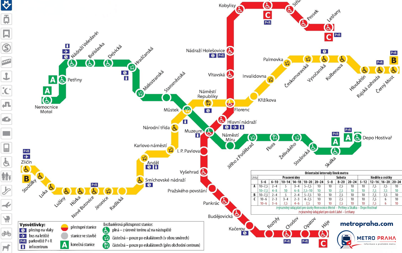
Prague Metro Map
The whole network on one map — 3 metro lines and 58 stations. Download the map below as a PNG or PDF.
Map of the Prague metro lines

The map shows all three metro lines along with connecting PID trams and buses. You can find the current official map at dpp.cz. Source: official DPP network map.

Frequently asked questions
The network has 58 stations and 3 lines — roughly 65 km of track. The map also shows connecting PID trams and buses.
Right here on this page — click the „Map PDF“ button and the file saves to your device. The map is also available as a PNG. Both are free, and suitable for printing or offline use.
Muzeum connects lines A and C right in the centre near Wenceslas Square. The other two hubs are Můstek (A+B) and Florenc (B+C), where the metro also connects to the Central Bus Station.
Yes, the map reflects the current shape of the network across all three lines, A, B and C. Check dpp.cz before you travel for any last-minute changes.